
Illustration


Via Egnatia was a major Roman road in the Balkans, stretching 1,120 kilometers (696 miles) from the Adriatic Sea in the west to the Black Sea and the Sea of Marmara in the east. The western terminus is slightly uncertain, often marked in Dyrrachium (modern Durrës) sometimes with Apollonia added, while the eastern end lies undoubtedly in Byzantium (modern-day Istanbul).
The road was constructed under Gnaeus Egnatius, the first Roman governor of the province of Macedonia after its conquest in 146 BCE. Via Egnatia was essentially a reconstruction and unification of key trade and travel routes connecting major cities such as Heraklia Lynkestis, Edessa, Pella, Thessaloniki, Amphipolis, and Philippi. The highway remained in use until the late medieval period, and today, parts of it are used as walking trails by visitors to Albania, North Macedonia, and northern Greece.
About the Author

Related Images
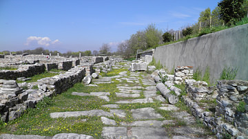
Via Egnatia in Philippi

Walking the Via Egnatia
Roman Rule in North Africa (146 BCE to 395 CE)
The Late Bronze Age Collapse c. 1200 - 1150 BCE
The Trojan Plain c. 1200 BCE
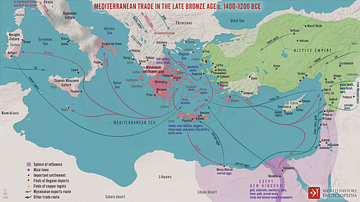
Mediterranean Trade in the Late Bronze Age c. 1400-1200 BCE
Cite This Work
APA Style
Choubineh, N. (2025, February 14). Via Egnatia, 146 BCE to c. 1200 CE. World History Encyclopedia. Retrieved from https://www.worldhistory.org/image/19903/via-egnatia-146-bce-to-c-1200-ce/
Chicago Style
Choubineh, Nathalie. "Via Egnatia, 146 BCE to c. 1200 CE." World History Encyclopedia. Last modified February 14, 2025. https://www.worldhistory.org/image/19903/via-egnatia-146-bce-to-c-1200-ce/.
MLA Style
Choubineh, Nathalie. "Via Egnatia, 146 BCE to c. 1200 CE." World History Encyclopedia. World History Encyclopedia, 14 Feb 2025. Web. 20 Feb 2025.