Search Maps
Latest Maps
Image
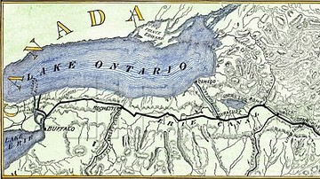
Map of Erie Canal
A map of Erie Canal c. 1840. The canal, constructed between 1817 and...
Image
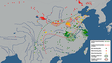
Possible Agricultural Centers in Prehistoric China
Map showing the spatial distribution of rice, millet, and mixed farming...
Image
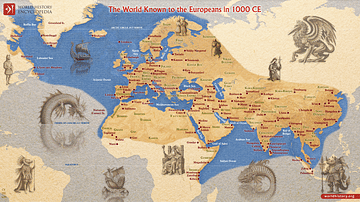
The World Known to Europeans in 1000 CE
In 1000 CE, Europeans had a limited but expanding awareness of the wider...
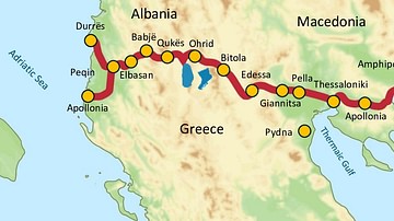
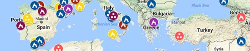
Image
Via Egnatia, 146 BCE to c. 1200 CE
Via Egnatia was a major Roman road in the Balkans, stretching 1,120...